
Why have drones increased in demand and usage in such a short timespan?
The reasons are many, but in this guide, we’ll focus on a specific use case: How Walden Environmental Engineering and Harkin Aerial have developed ways to use drones to improve water quality, map water infrastructure, and detect/locate issues in drinking water and stormwater utility infrastructure.
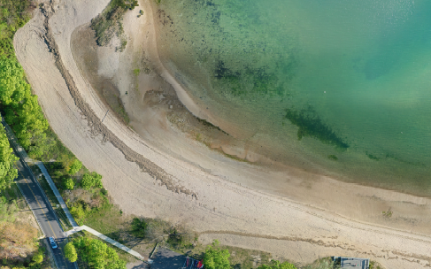
Why use a drone in the first place?
There are several key reasons why drones are very effective for analyzing stormwater issues. First, they are able to cover a large area quickly, but in great detail – a single drone can easily map a 50 acre space in well under an hour, including setup and breakdown. Doing the same on foot could easily take days depending on terrain and environment, while manned aircraft are typically too costly and the operation too complex for areas under a few hundred acres.
Satellite imagery, while often free, generally provides a resolution of 1-2 feet per pixel. By comparison, drone imagery can achieve < 1 inch per pixel – up to 30X higher resolution. While satellite imagery is ideal for analyzing large areas of land (over 500 acres), most sites fall into the category where drones win out – not just on resolution, but in acquisition time. On-request satellite imagery is generally provided on a yearly or quarterly basis and the premium to obtain more recent data is extremely high. A drone can easily be deployed on a daily or weekly basis with little increase in costs.
Additionally, costs are saved compared to the labor required to do the same work on the ground. Drones are able to carry a large variety of payloads, from thermal cameras, to high resolution photography cameras, to LIDAR, and more. Drone payloads are often very versatile, offering multiple cameras in one unit, or the ability to quickly swap out payloads in the field to use on separate flights to capture the required data.
With water management specifically, aerial thermography, aerial photography, and aerial photogrammetry are especially well-suited to closely inspecting infrastructure, revealing unseen water temperature changes, obtaining 3D terrain data to use for hydrology, and GIS mapping of assets and features. This guide provides specific examples of how Walden and Harkin are using drones to manage and improve water infrastructure.
Stay tuned for more information on Walden’s GUIDE TO DRONES IN ENVIRONMENTAL ENGINEERING: How Drones Are Mapping Sites, Improving Water Quality & Managing Infrastructure.