Drones and Remote Sensing
Walden, through our strategic partnership with Harkin Aerial, provides expert Unmanned Aerial Systems (UAS) operation and consulting services to public and private clients alike. UAS–also known as drones–provide an affordable and powerful alternative to traditional aerial imaging. Our team of UAS pilots, engineers, and GIS professionals can provide a turnkey solution to your aerial imaging needs. By deploying drones, Walden can drastically cut down on the time and cost to generate site plans and obtain data relevant to your project. Walden’s expertise with high-resolution photography cameras, thermal cameras, LIDAR, and other payloads allow Walden to collect a vast amount of site data, typically within a single site visit.
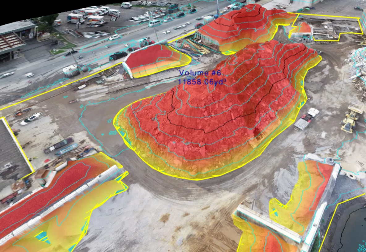
Walden’s team of experts can help you maximize the benefits of using drones today without incurring significant upfront startup costs with drone hardware and software. Walden’s engineering staff are well-versed in UAS operations and are qualified to capture, process, and analyze drone acquired data and produce deliverables such as CAD plans, orthomosaics, cut/fill volume calculations, GIS linework and base maps, thermal inspection reports, and more. Walden’s team of photogrammetry and LIDAR professionals can create stunning 3D visualizations and measurements of your site, even in high-vegetation areas typically unsuitable for traditional aerial mapping.
Walden has developed considerable expertise in aerial thermography, and our staff includes ITC-rated Level II Thermographers qualified to perform thermal inspections from the air. Walden has recently applied this expertise towards our innovative research in Aerial Thermal Leak Detection and Illicit Discharge.
WALDEN’S DRONE TECHNOLOGY SERVICES ARE LISTED BELOW:
- Aerial Photography and Video
- GIS Data Acquisition
- Aerial Mapping: DEM, Contour, and Orthomosaic Generation
- Landfill Modeling and Mapping
- Watershed Mapping and Analysis
- Photogrammetry and 3D Point Cloud Generation
- LIDAR and Laser Scanning
- 3D Volumetrics and Cut and Fill Calculations
- Thermal Imaging and Inspection
- Infrastructure and Industrial Inspections
- Water Leak and Illicit Discharge Detection
- Air Quality Monitoring and Gas Detection
- 3D Modeling and Data Visualization
PROJECTS:
PART 360 SOLID WASTE – DRONE TOPOGRAPHY AND VOLUME CALCULATIONS
MS4 ILLICIT DISCHARGE DETECTION INVESTIGATION USING THERMAL IMAGING UAVS
USING DRONES TO MAP FACILITIES

