
As part of ongoing improvements to a facility in the Hudson Valley, Walden and Harkin have mapped the facility using drones to document construction progress, create roof plans for HVAC and solar panel installation, and create updated topography for future construction projects.
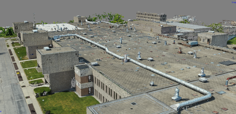
High-resolution orthomosaics (stitched imagery) and DEMs (Digital Elevation Models) were generated for each project, allowing the project engineer to measure heights, distances, slopes, and areas for terrain, parking lots, roofs, and buildings. By using drone technology, measurements that would typically take multiple days to complete can be accomplished in a matter of hours.
For interior spaces where drone use is difficult or impossible, Walden and Harkin utilized mobile LIDAR to scan spaces in excess of 100,000 sq feet in half a day. From point cloud data generated by the LIDAR, critical measurements can be extracted such as plumbing/ductwork locations and dimensions, floor square footage and slopes, pipe slopes, trenching dimensions and volume, etc. This rapid scanning technology allowed Walden to confirm dimensions in real-time as construction progressed in interior spaces.
Walden’s unique expertise with operations at iPark 84 allowed for strong coordination between Harkin’s drone/LIDAR services and the iPark staff/engineers to accomplish iPark’s goals. Additionally, Walden engineers are highly experienced in turning drone photogrammetry and LIDAR data into complete engineering documents used in bidding, design, and construction for various iPark projects.