
 In our fast-paced digital world, remediation project success depends on effective environmental data management. For site managers, environmental consultants, field crews, and clients alike, success hinges on thorough and accurate environmental data collection at the outset of the project.
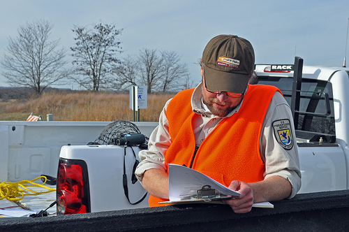
An environmental database management system (EDMS) can ensure every project gets off to the right start. It can especially be useful to help your geologists, hydrogeologists, scientists and engineers significantly improve the speed and accuracy of their soil and groundwater data collection. Using an EDMS can streamline every step of your work process.
Specifically, an EDMS can help your team make the most of your environmental data collection in these ways:
- An EDMS helps manage environmental data collection workflow. Allowing team members to work independently or together supports more efficient time management and speeds up the overall process.
- You can collect and import data much faster, from a variety of sources, directly to a central database. Mobile devices eliminate the need for maps and hand-written notes, instead using the latest technology to provide web-based data collection and management. You can record and transmit data immediately, or store it for later upload if internet access is unavailable in the field.
- You can increase data accuracy by eliminating hand-entry, duplicate input and potential transcription errors. This can also provide considerable labor savings.
- You can use your database to build a legacy reference library. It’s easy to upload or enter existing historical data, then add new data as it’s collected.
- Data is easy to access, even remotely, at any time. With immediate access to reports, you can view historical data in the field.
- The system performs data checks and quality assurance right at the point of collection, and it maintains a complete and permanent audit trail, including GIS references, indicating specifically who collected what data, where and when.
- GIS interface also works in tandem with an EDMS. This enables engineers and other technical staff as well as non-technical users to clearly see events, geographic features and changes to remedial conditions, all in a visual format.
- You can use your data to create inventories, landowner records, visualizations, reports and other documents, charts and graphs.
- You can easily track ongoing monitoring efforts or investigations, regardless of size or complexity. Collecting large quantities of separate data groupings, even in inconsistent formats or metrics, is no longer a problem, because the system automatically converts the data as necessary to assure straightforward, consistent comparison.
An environmental database management system provides a level of flexibility and an ability to integrate work processes previously unheard of. It can greatly enhance environmental data collection, by reducing collection time and field costs, increasing data quality, and maximizing how — and how quickly — data can be used.